
UTM Recreational Forest
"Discover UTM Recreational Forest: A Hidden Gem for Eco-Tourism, Featuring Scenic Trails, Breathtaking Waterfalls, and Rich Biodiversity – Your Gateway to Nature’s Adventure!"
Attractions and Trails
"Adventure Awaits: Explore Scenic Trails, Hidden Waterfalls, and Thrilling Canopy Walkways in UTM Recreational Forest – Your Ultimate Nature Escape!"
Nature
"Immerse Yourself in Nature’s Splendor: Discover Lush Greenery, Diverse Wildlife, and Serene Landscapes in UTM Recreational Forest – A Sanctuary for Nature Lovers!"
About
Nestled within the Universiti Teknologi Malaysia (UTM) campus, the UTM Recreational Forest is a 53-hectare natural haven, offering
- Lush greenery.
- Diverse flora and fauna.
- Stunning hilly landscapes.
Managed by the Ecotourism Campus Unit since October 1, 2009, the forest was developed with a vision to promote eco-tourism and environmental education. With an initial budget of nearly RM 80,000, the forest now boasts special features like a Herbal Garden, Nadir Plants collection, and an Observation Tower (part of the Phase II development project from 2017-2021). These unique attractions set UTM Recreational Forest apart from other recreational forests.
Read moreActivities
Type of Facilities
Hard Workers
Vistors (last 3 years)
Activities
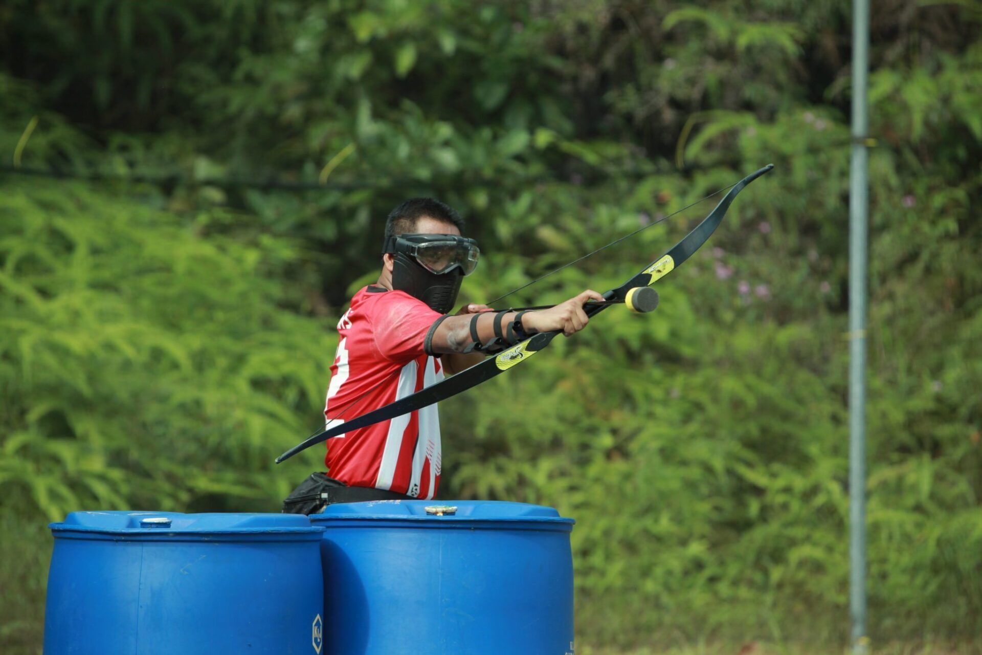
Archery & Combat
Star Rating of Recommendation
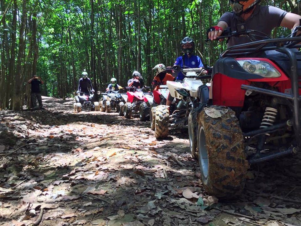
All-Terrain Vehicle (ATV)
Star Rating of Recommendation

BumperBall
Star Rating of Recommendation
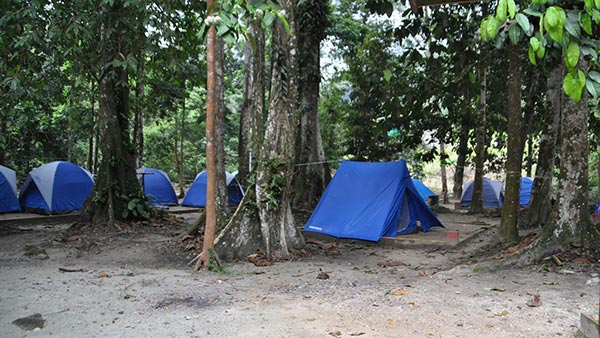
Camping
Star Rating of Recommendation
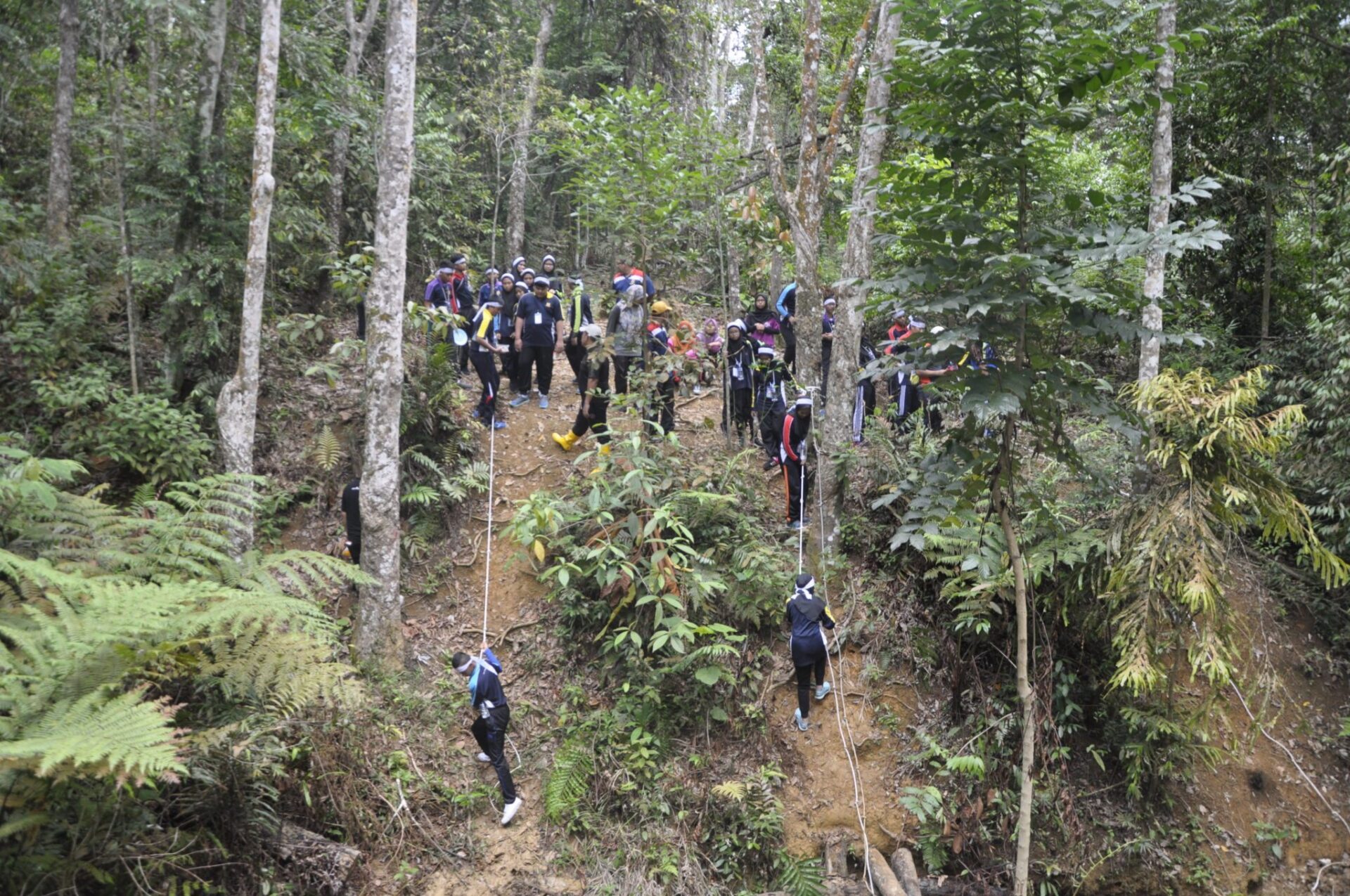
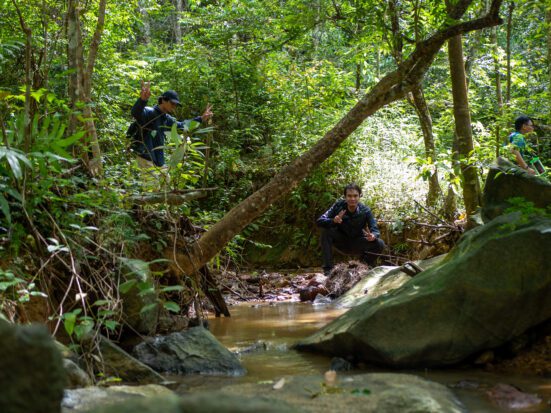
Jungle Trekking
Star Rating of Recommendation
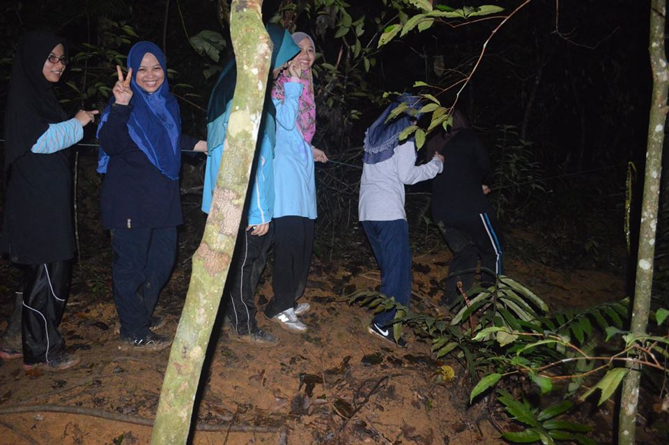
Nightwalk
Star Rating of Recommendation
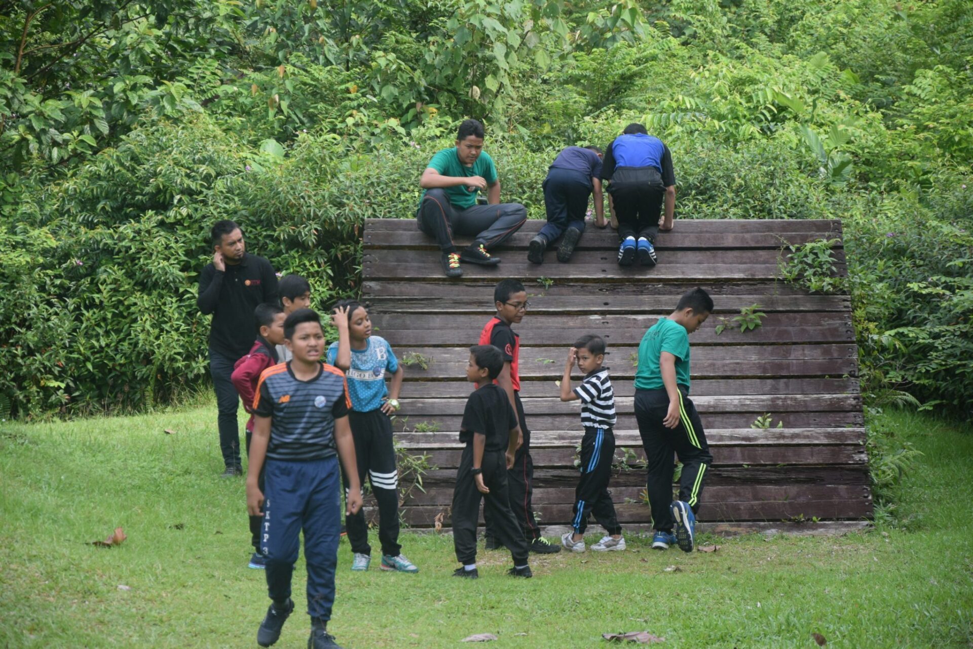
Obstacle
Star Rating of Recommendation

Paintball
Star Rating of Recommendation
Attractions & Trails

Lata Jernih

Pulai Tree
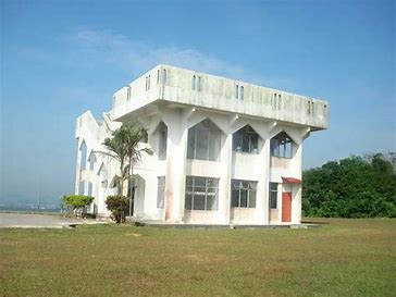
Observatory (Balai Cerap)
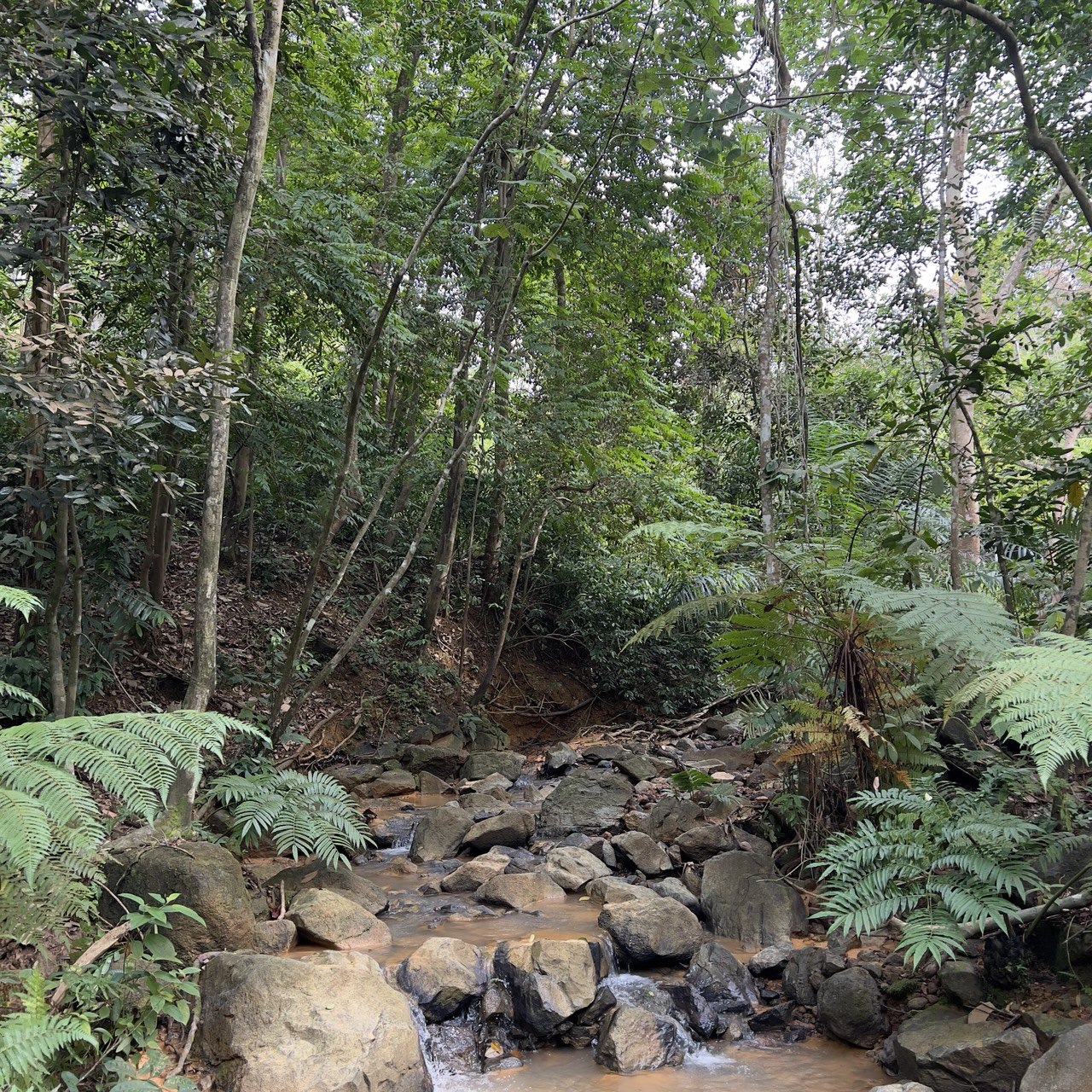
Stream & River

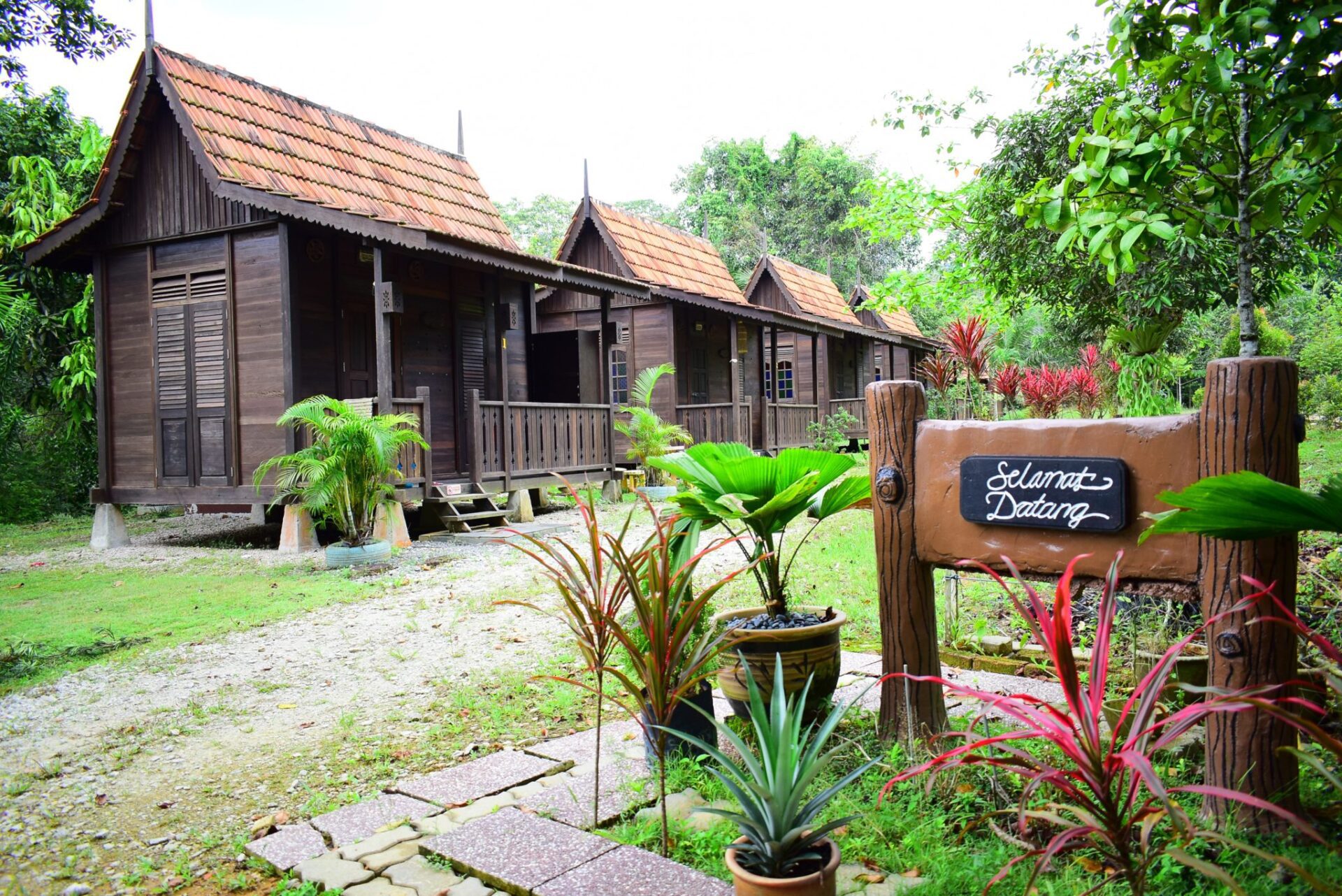
Chalet (Rumah Kampung)
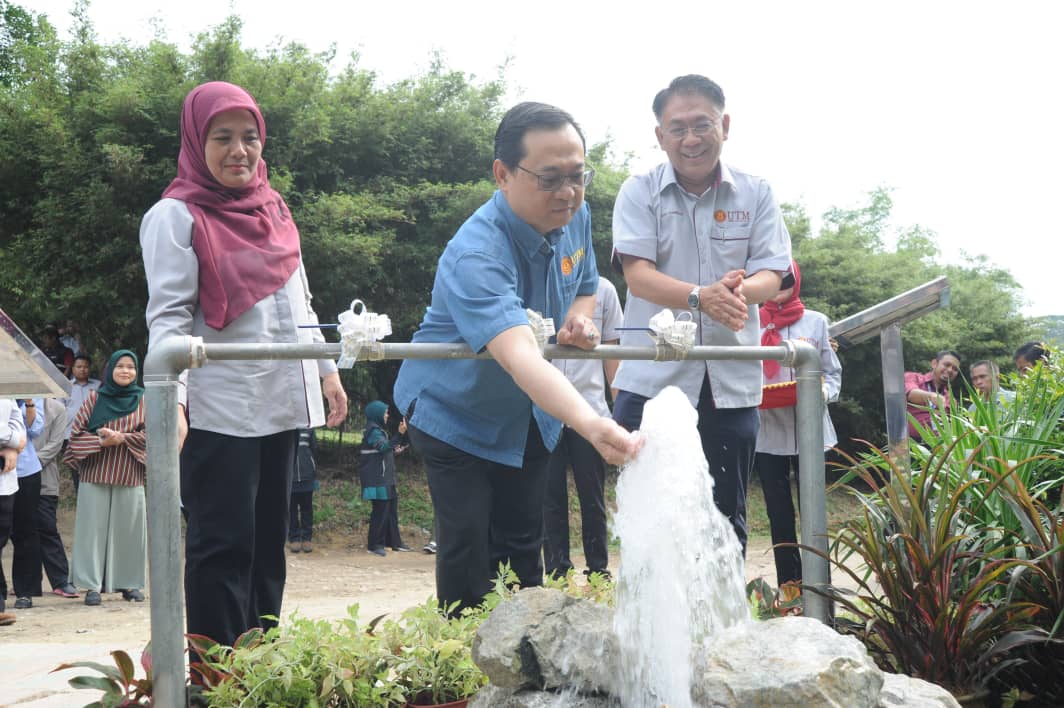
Rock Aquifer Water
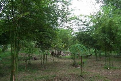
Bamboo Garden
Trails
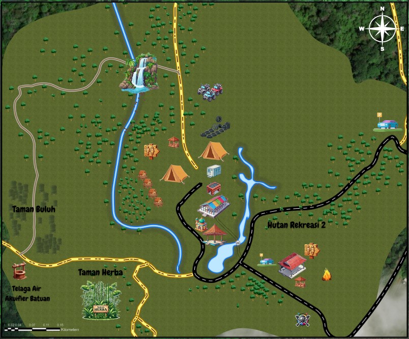
MAP
TOURISM MAP
Sireh park have a lot of attractive place
- HIKING TRAILS, NIGHT WALK TRAILS,ATV TRAILS, MOUNTAIN BIKE TRAILS.
- STREAM, FISHING POUNDS, BAMBOO GARDEN, HERBAL GARDEN, .
- KITCHEN, AND BBQ AREA.
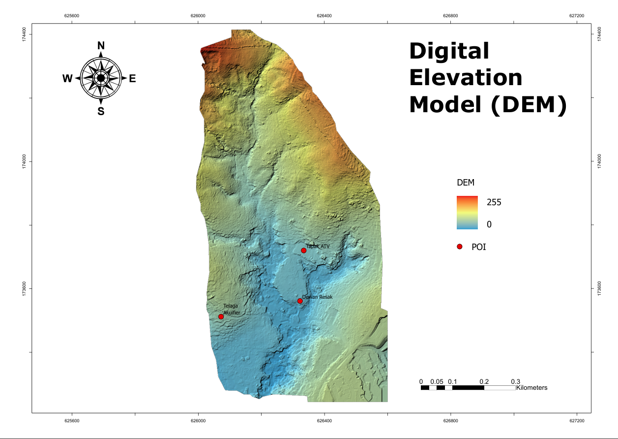
DEM MAP
A Digital Elevation Model (DEM) is a digital representation of the Earth's surface, capturing elevation data for every point on the map. Created using advanced technologies like satellite imagery, LiDAR, and aerial surveys, DEM maps offer unparalleled insights into the shape and structure of our planet.
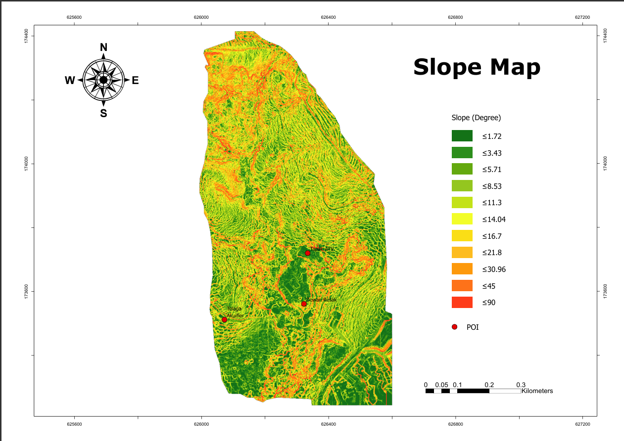
SLOPE MAP
The slope value represents the steepness or incline of the terrain in a specific area. It indicates how much the elevation (height) changes over a certain distance, expressed as a percentage.
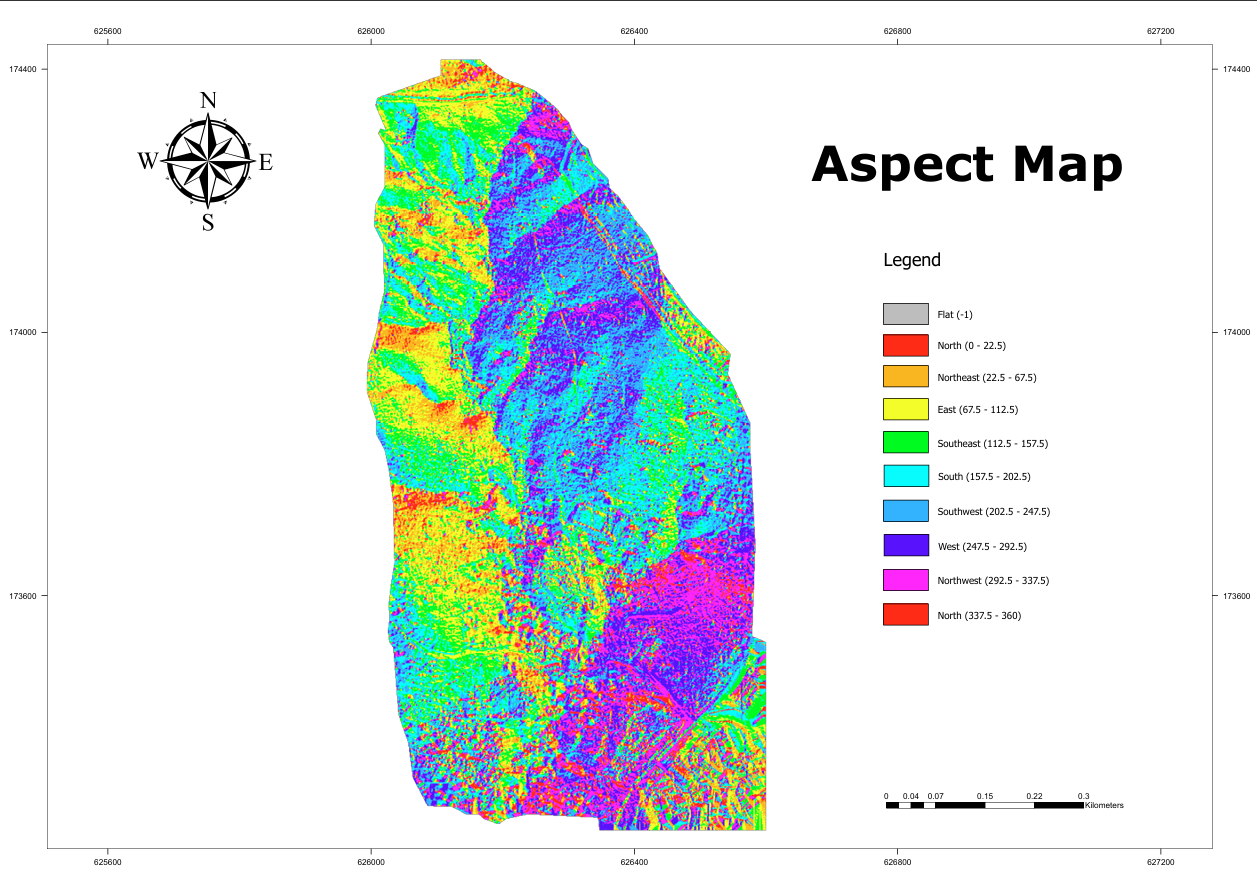
ASPECT MAP
Once the aspect is determined, it provides valuable information about the orientation of the terrain. For example, a slope facing north might receive less direct sunlight, influencing factors like vegetation growth and temperature distribution..
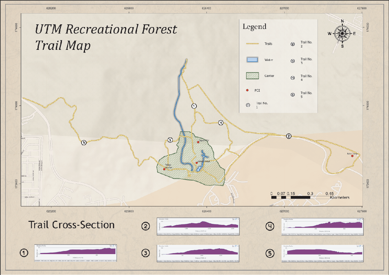
Trails
The UTM Recreational Forest offers a variety of trails with different difficulty levels. This trail features steep inclines and uneven terrain, making it a tough but rewarding hike. The elevation ranges from 27 to 73 meters above sea level. This trail leads to the Observation Tower and involves a significant climb. The path can be quite steep and requires good physical fitness. While primarily known for its botanical interest, this trail also includes some challenging sections with hilly terrain and dense vegetation.
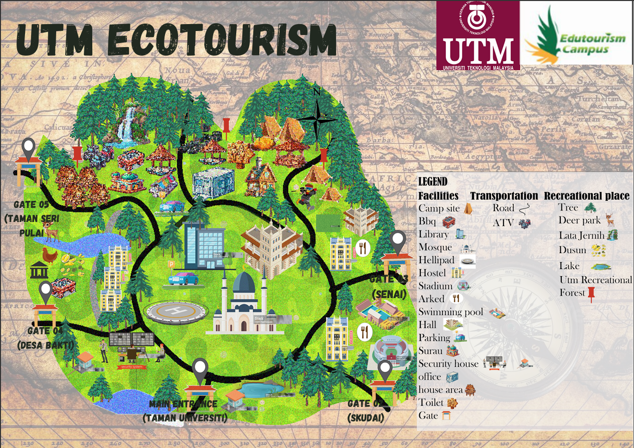
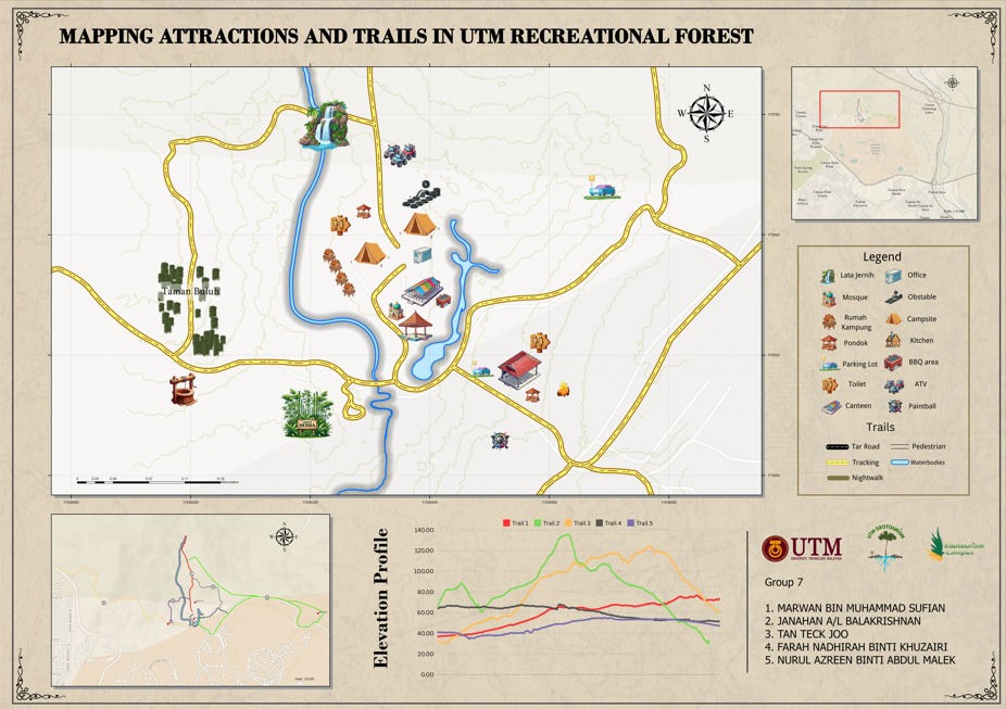
Attractions and Trails in UTM Recreational Forest
The UTM Recreational Forest is a beautiful 53-hectare reserved forest located within the Universiti Teknologi Malaysia (UTM) campus. It offers a variety of attractions and trails for nature lovers and adventure seekers. 8 type of activities, 6 type of attraction place and 5 type of trails with different difficulty levels. These attractions and trails provide a great mix of educational and recreational opportunities.
MAP
MAP
Team
MARWAN BIN MUHAMMAD SUFIAN
Project Manager
JANAHAN A/L BALAKRISHNAN
GIS Analyst
FARAH NADHIRAH BINTI KHUZAIRI
GIS Analyst
NURUL AZREEN BINTI ABDUL MALEK
GIS Technician
TAN TECK JOO
GIS Developer
Dr. Mohammad Zakri bin Tarmidi
Project SupervisorContact
Address
UTM GEOTOURISM
Aras Bawah, Blok F53, Kompleks Bahagian Pengurusan Aset,
Universiti Teknologi Malaysia 81310, Skudai, Johor.
Call Us
(+607) 553 0609
Email Us
utmgeotourism@utm.my
© Copyright Team7 All Rights Reserved